Reimagining Rikers Island
Welcome to DEP’s Feasibility Study Information Website
Background
This Study
Renewable Rikers Laws
In 2021, the City Council passed a series of laws to consider future uses for Rikers Island. Those laws, collectively called the “Renewable Rikers Laws,” include:
New York City Local Law 16 of 2021
Establishes a process to transfer the land, buildings, and facilities of Rikers Island to the New York City Department of Citywide Administrative Services and establishes the Rikers Island Advisory Committee.
New York City Local Law 17 of 2021
Expands the City’s long-term energy plan being conducted by the Mayor’s Office of Climate and Environmental Justice to include a study of the feasibility of different types of renewable energy sources combined with battery storage on Rikers Island.
New York City Local Law 31 of 2021
Requires DEP to conduct a study to assess the feasibility of constructing a wastewater treatment facility on Rikers Island.
Borough-based Jail Plan
A Roadmap to Closing Rikers
For information about the City’s plan to close Rikers Island and create a borough-based jail system, visit A Roadmap to Closing Rikers.
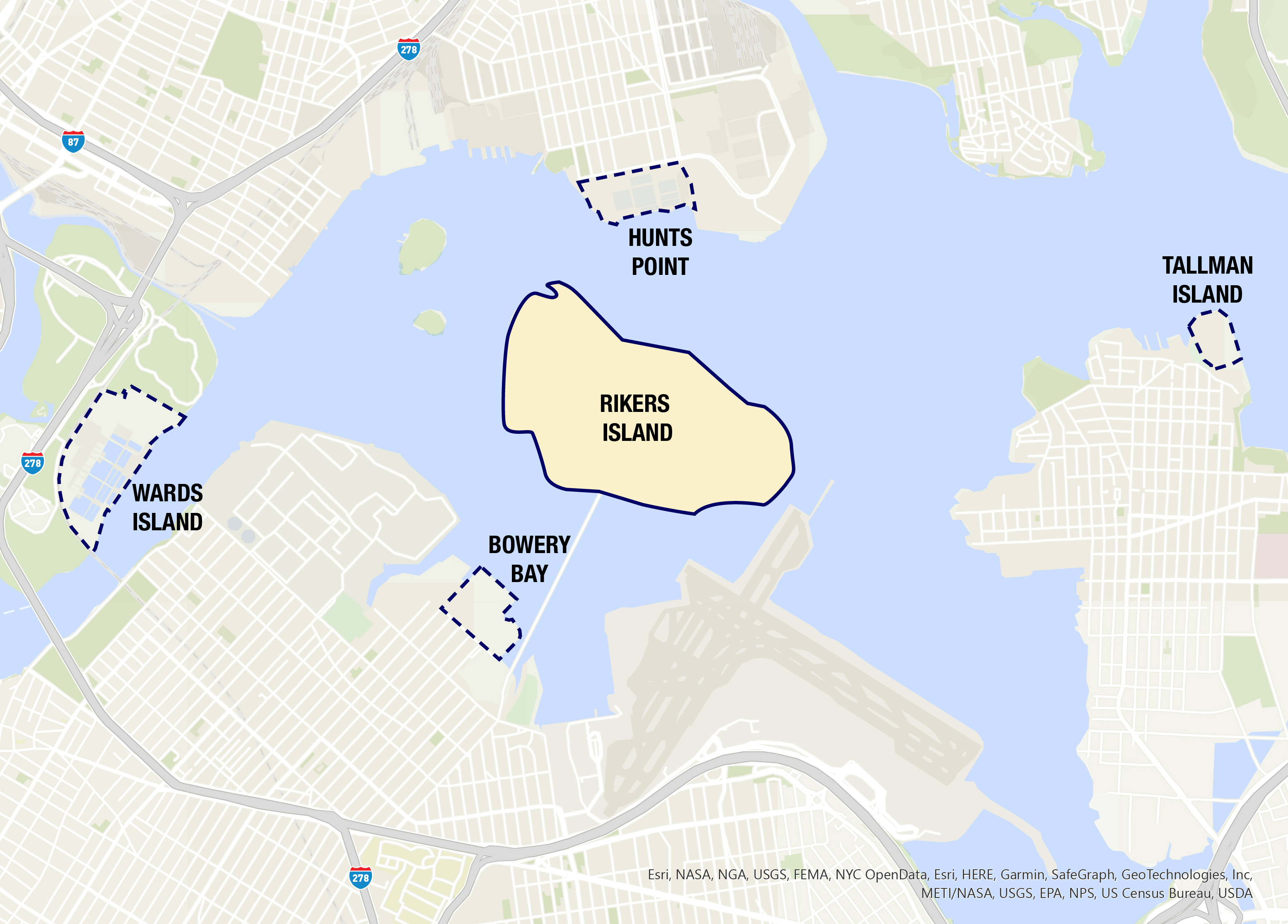
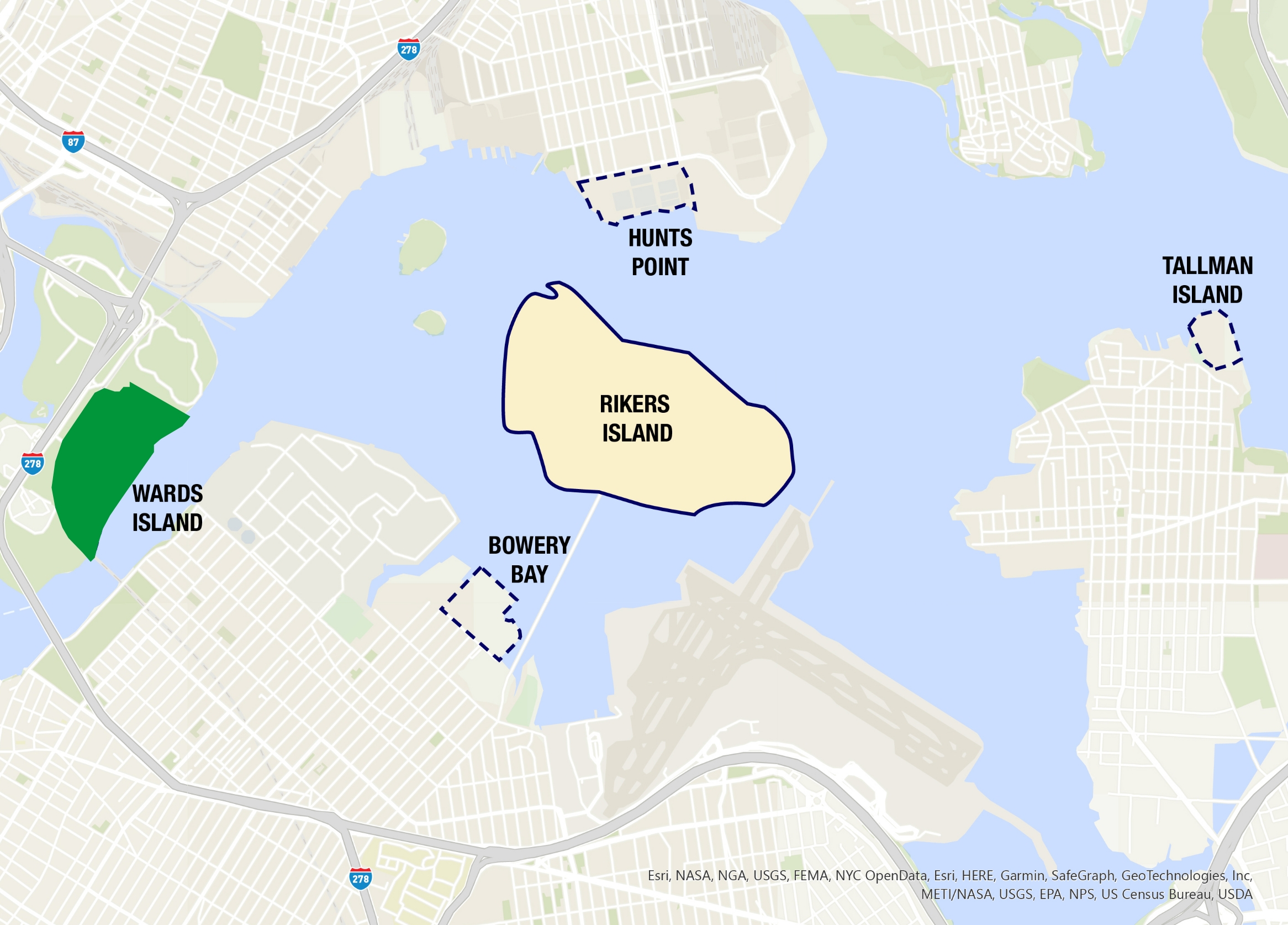
Rikers Island and Study Sites
This Study assessed the feasibility of consolidating the Bowery Bay, Hunts Point, Tallman Island, and Wards Island WRRFs into one facility on Rikers Island.
These WRRFs are all less than two miles from Rikers Island. They serve neighborhoods in the Bronx, Manhattan, and Queens.
Each of the four WRRFs is nearly 100 years old. They are still functioning and serving the community, but as treatment technology improves and water quality requirements change, these older facilities will require significant investment keep up.
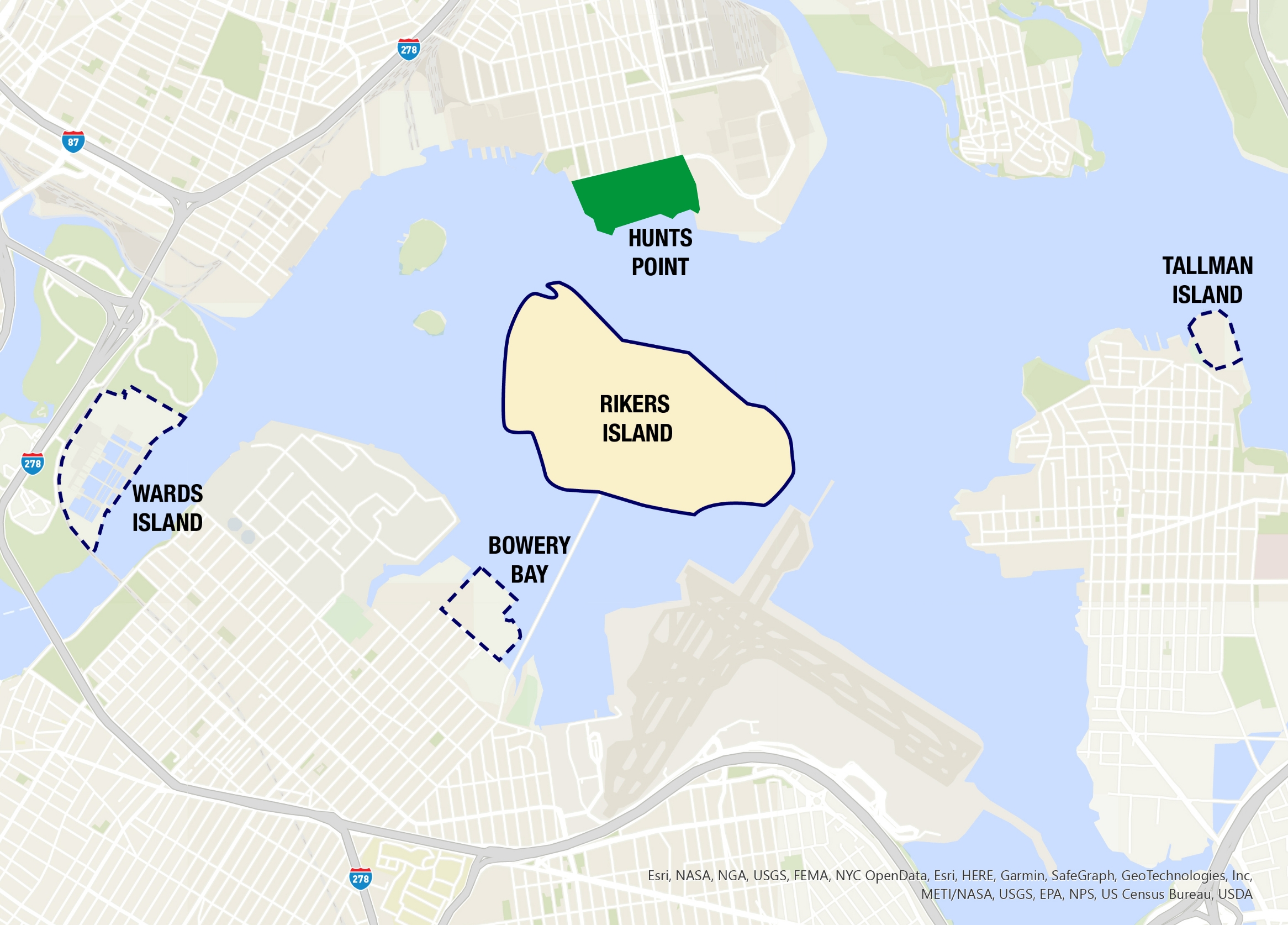
Hunts Point
Hunts Point
| In operation since | 1952 |
|---|---|
| Design Capacity | 200 million gallons per day |
| Population Served | 684,569 |
| Receiving Waterbody | Upper East River |
| Drainage Area | 16,664 acres, eastern section of the Bronx |
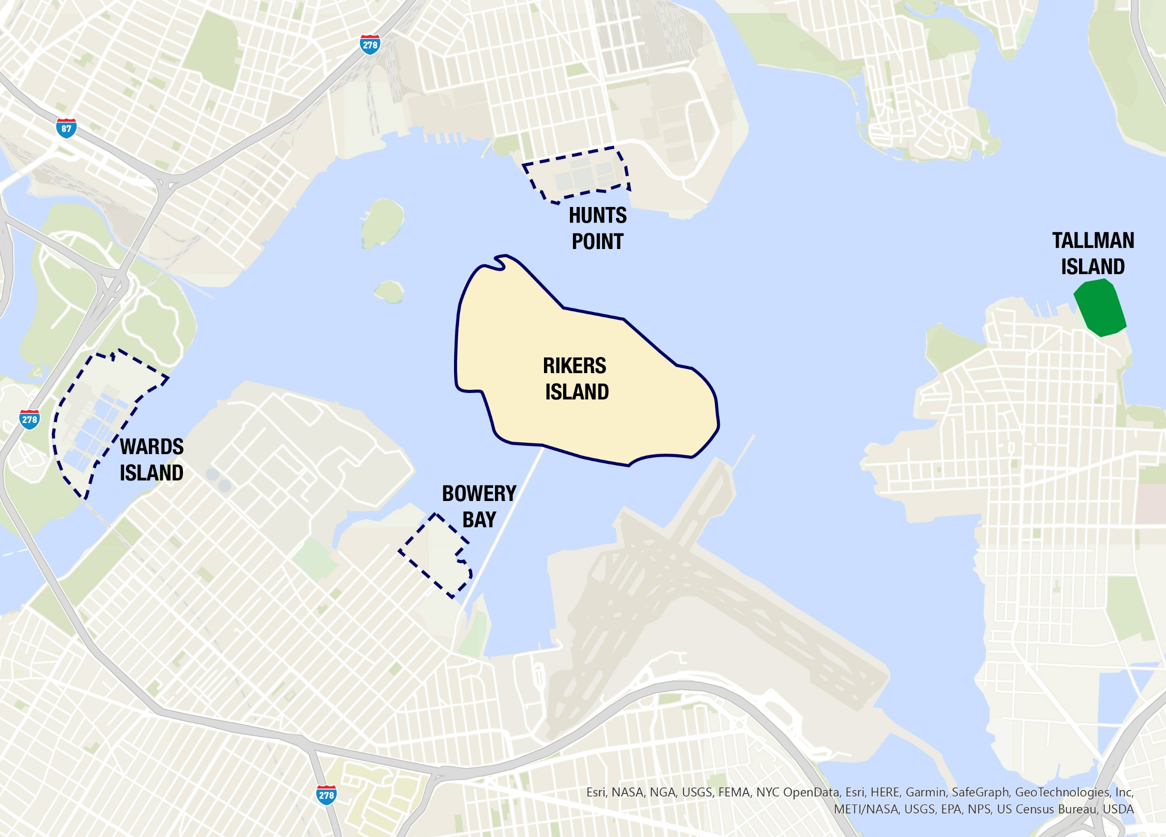
Tallman Island
Tallman Island
| In operation since | 1939 |
|---|---|
| Design Capacity | 80 million gallons per day |
| Population Served | 410,812 |
| Receiving Waterbody | Upper East River |
| Drainage Area | 16,860 acres, northeast section of Queens |
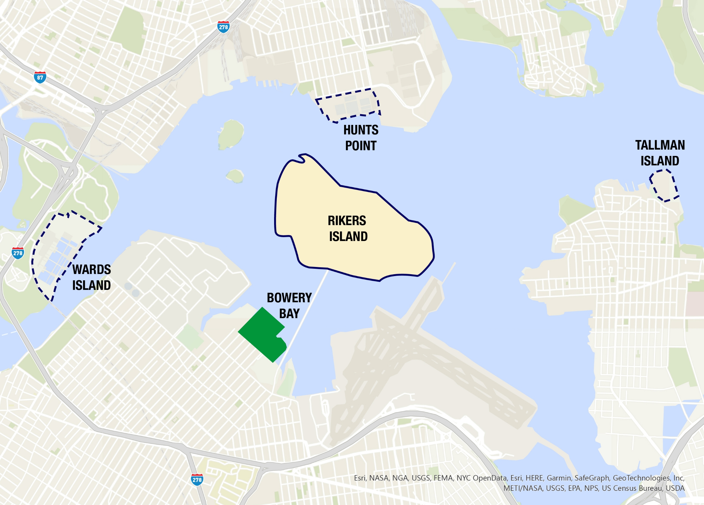
Bowery Bay
Bowery Bay
| In operation since | 1939 |
|---|---|
| Design Capacity | 150 million gallons per day |
| Population Served | 848,328 |
| Receiving Waterbody | Upper East River |
| Drainage Area | 15,203 acres, northeast section of Queens |
Wards Island
Wards Island
| In operation since | 1937 |
|---|---|
| Design Capacity | 275 million gallons per day |
| Population Served | 1,061,558 |
| Receiving Waterbody | Upper East River |
| Drainage Area | 12,056 acres, western section of the Bronx and upper east side of Manhattan |
![]()
Hunts Point

In operation since: 1952
Design Capacity: 200 million gallons per day
Population Served: 684,569
Receiving Waterbody: Upper East River
Drainage Area: 16,664 acres, eastern section of the Bronx
![]()
Wards Island

In operation since: 1937
Design Capacity: 275 million gallons per day
Population Served: 1,061,558
Receiving Waterbody: Upper East River
Drainage Area: 12,056 acres, western section
of the Bronx and upper east side of Manhattan
![]()
Bowery Bay

In operation since: 1939
Design Capacity: 150 million gallons per day
Population Served: 848,328
Receiving Waterbody: Upper East River
Drainage Area: 15,203 acres, northeast section of Queens
![]()
Tallman Island

In operation since: 1939
Design Capacity: 80 million gallons per day
Population Served: 410,812
Receiving Waterbody: Upper East River
Drainage Area: 16,860 acres, northeast section of Queens